

The 1921 British Mount Everest reconnaissance expedition was the first organised attempt to explore Everest at close quarters. Led by Charles Howard-Bury, it spent five months in Tibet, mapped thousands of square kilometres of unknown country and, on 24 September 1921, put George Mallory, Guy Bullock and Edward Oliver Wheeler on the North Col at about 7,000 m, revealing the route used by every pre-war expedition and still followed from Tibet today.
It was a reconnaissance, not a summit bid, and it cost the life of its most experienced Himalayan climber, Alexander Kellas. This guide covers why it happened, who went, the route through Tibet, how the team found the way to the North Col, and what it achieved.
The 1921 Everest reconnaissance at a glance
| Details | |
|---|---|
| Organised by | Mount Everest Committee (Royal Geographical Society and Alpine Club), chaired by Sir Francis Younghusband |
| Leader | Lieutenant-Colonel Charles Howard-Bury |
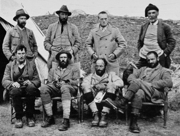
| Climbers | Harold Raeburn (climbing leader), Alexander Kellas, George Mallory, Guy Bullock |
| Surveyors and scientists | Henry Morshead and Edward Oliver Wheeler (Survey of India), Alexander Heron (geologist), Alexander “Sandy” Wollaston (doctor and naturalist) |
| Departed Darjeeling | 18 May 1921 |
| Approach | Sikkim, the Jelep La, the Chumbi Valley, Phari, Kampa Dzong, Shekar Dzong and Tingri in Tibet |
| Key discovery | The East Rongbuk Glacier leads to the North Col and the North Ridge |
| High point | North Col, about 7,000 m, reached 24 September 1921 |
| Death | Alexander Kellas, heart failure near Kampa Dzong, early June 1921 |
| Returned to Darjeeling | Late October 1921 |
Why a reconnaissance was needed
By 1921 Everest had been known as the world’s highest mountain for 65 years, since the Survey of India announced its height of 29,002 ft in 1856. Yet no European had been within about 60 km of it. Nepal was closed to foreigners and Tibet was largely closed too, so the mountain had only been observed and measured from distant survey stations in India.
British interest had been building for years. Plans for an Everest reconnaissance were discussed around 1907, the Alpine Club’s 50th anniversary, with Charles Bruce as a possible leader, but the India Office refused permission. In 1913 Captain John Noel had travelled secretly towards Everest in disguise, and the First World War then put everything on hold.
After the war, the Royal Geographical Society, led by its president Sir Francis Younghusband, revived the idea. Howard-Bury travelled to India in 1920 and helped win support from the Viceroy, while Sir Charles Bell, the British political officer in Sikkim who knew the 13th Dalai Lama well, secured permission from the Tibetan government in late 1920. In January 1921 the Royal Geographical Society and the Alpine Club formed the joint Mount Everest Committee to fund and organise the expeditions.
The committee agreed that 1921 would be a reconnaissance: find the mountain, map the approaches and identify a practicable route. A full attempt on the summit would follow in 1922.
The members of the 1921 expedition
| Member | Role | Notes |
|---|---|---|
| Charles Howard-Bury | Leader | Irish-born army officer and traveller; had entered Tibet unofficially in 1905. Wrote the official account and received the RGS Founder’s Medal in 1922. |
| Harold Raeburn | Climbing leader | Leading Scottish mountaineer in his mid-fifties. Fell ill with dysentery on the approach and spent much of the summer recovering in Sikkim, rejoining the team in late August. |
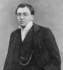
| Alexander Kellas | Climber and scientist | Scottish chemist and the most experienced Himalayan climber of his day; studied high-altitude physiology and oxygen. Died on the approach march. |
| George Mallory | Climber | Schoolteacher and rock climber in his mid-thirties with no Himalayan experience; became the de facto lead climber. |
| Guy Bullock | Climber | Diplomat and Mallory’s school friend from Winchester; Mallory’s partner throughout. His diaries were published in the Alpine Journal in 1962. |
| Henry Morshead | Surveyor | Survey of India officer; led the large-scale survey of the region. |
| Edward Oliver Wheeler | Surveyor | Canadian Survey of India officer who used photo-surveying to map the mountain’s surroundings; later Surveyor General of India. |
| Alexander Heron | Geologist | Geological Survey of India; mapped the geology of a large area of southern Tibet. |
| Sandy Wollaston | Doctor and naturalist | Collected plants, birds and mammals, including species new to science. |
The expedition also depended on Indian surveyors, including Lalbir Singh Thapa, Gujjar Singh and Turubaz Khan, on interpreters, and on dozens of Sherpa, Bhotia and Tibetan porters and mule drivers. Sherpas including Ang Pasang, Lagay and Gorang were with Mallory on the final push to the North Col. Their skill and endurance impressed the British climbers and set the pattern for Sherpa involvement in every expedition since, from Tenzing Norgay’s first job as a porter in 1935 to today’s record holders. Read more in our Tenzing Norgay biography.

The approach march through Sikkim and Tibet
The expedition left Darjeeling on 18 May 1921 in two parties for a march of roughly 480 km (300 miles). Army mules carried the stores at first, later replaced by local mules and yaks.
- Sikkim: through the hot, leech-ridden Teesta valley and over the Jelep La pass into Tibet.
- The Chumbi Valley and Phari: up the Chumbi Valley to Phari Dzong at about 4,400 m, gateway to the Tibetan plateau.
- Across the plateau: west over the Tang La and the bleak, windswept plateau towards Kampa Dzong.
- Kampa Dzong to Tingri: on via Shekar Dzong to Tingri, which became the base for the first explorations of the north side.
The death of Alexander Kellas
Both senior climbers fell ill with dysentery on the plateau. Kellas, aged 53, had arrived in Darjeeling exhausted from a season of climbing in Sikkim and grew steadily weaker; he had to be carried on a litter. He died of heart failure near Kampa Dzong in early June (most accounts give 5 June, some 6 June) and was buried there, within sight of the Sikkim peaks he had climbed.
Kellas’s loss was a heavy blow. His 1911 ascent of Pauhunri (about 7,128 m) in Sikkim made him one of the highest climbers of his time, and his research with the physiologist J. S. Haldane had led him to argue, correctly as it turned out, that Everest might be climbed without bottled oxygen. Raeburn was sent back to Sikkim to recover, leaving Mallory and Bullock, neither of whom had been to the Himalaya before, as the only active climbers.
The northern reconnaissance: the Rongbuk glaciers
On 23 June Mallory and Bullock set off south from near Tingri with a team of Sherpas, and on 25 June they got their first clear view of Everest’s north side. They set up a base near the Rongbuk Monastery at around 5,000 m and began exploring the Main Rongbuk Glacier.
The glacier was harder going than anything they knew from the Alps, choked with ice towers (seracs) up to about 15 m high. Over several weeks they explored its branches and climbed nearby peaks for a view:
- Ri-Ring, 5 July: Mallory and Bullock climbed this peak of about 6,900 m on the western side of the glacier to study the North Col and Northeast Ridge.
- The West Rongbuk and the Lho La, mid-July: by around 19 July they reached a col on the Lho La and looked down into the Khumbu Icefall and a high hanging valley that Mallory named the Western Cwm, using the Welsh word for a valley. They judged the southern approach impractical; it would be another 30 years before the 1951 reconnaissance proved them wrong, from Nepal.
Their key mistake was missing the narrow entrance to the East Rongbuk Glacier, which joins the main glacier from the east. From Ri-Ring they believed a ridge blocked the way, and they concluded the North Col could only be reached from the far side.
There was also a photographic setback. Mallory had loaded his photographic plates the wrong way round, so many of his early pictures were blank, and he and Bullock spent two extra days retaking them. On 25 July they rejoined Howard-Bury, and four days later the expedition moved east to the Kharta valley.

The eastern reconnaissance: the Kama valley and the Kangshung Face
From Kharta, Mallory and Bullock crossed a pass of about 5,500 m into the beautiful Kama valley in early August and saw Everest’s huge East (Kangshung) Face. It was menaced by hanging glaciers and avalanches, and they ruled it out. On 7 August they climbed Kartse (about 6,520 m) for a view of the North Col from the east.
Wheeler’s breakthrough
The solution came from the survey work. By mid-August Wheeler, mapping the area with his photographic survey, had worked out that the glacier flowing from the North Col turns north and joins the Rongbuk: this was the East Rongbuk Glacier that Mallory and Bullock had missed. It offered a way to the foot of the North Col.
Bullock also found a high pass at the head of the Kharta Glacier. On 18 August the climbers reached this pass, the Lhakpa La (“Windy Gap”) at about 6,800 m, from which they could look down on the upper East Rongbuk Glacier and across to the North Col. The way was clear.
September 1921: reaching the North Col
The team waited out the monsoon snows and moved to an advance base at around 5,300 m at the end of August, where Raeburn rejoined them. On 20 September Mallory, Bullock, Morshead and Wheeler crossed the Lhakpa La and camped on the far side.
On 24 September Mallory, Bullock and Wheeler, with three Sherpas, climbed the slopes to the North Col at about 7,000 m (7,020 m on most modern maps). Mallory could see the North Ridge rising towards the summit and believed it was climbable. But a fierce wind was blowing across the col, the party was tired, and food and fuel were running low. Mallory decided that going higher would be reckless.
The next day gales forced them back to the Lhakpa La, and by 26 September the upper camps had been struck. The expedition returned to Darjeeling in late October 1921.
The “abominable snowman”
The 1921 expedition also gave the world a famous phrase. On the approach to the Lhakpa La, the team saw large footprints in the snow. Howard-Bury thought they were probably made by a wolf, but the porters attributed them to a creature they called “metoh-kangmi”. When the journalist Henry Newman of The Statesman in Calcutta reported the story, he rendered the name as “abominable snowman”, and the yeti legend entered popular culture.
What the 1921 expedition achieved
| Area | Outcome |
|---|---|
| Route | Identified the Rongbuk–East Rongbuk–North Col–North Ridge route, used in 1922, 1924 and every pre-war attempt, and today the standard route from Tibet |
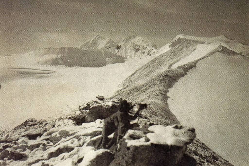
| Survey | Morshead’s team mapped about 31,000 km² at 1:250,000; Wheeler’s photo-survey produced a 1:63,360 (one inch to the mile) map of Everest’s surroundings |
| Science | Heron mapped the geology of a wide area; Wollaston collected new plant, bird and mammal specimens |
| Knowledge | First close-up views of the north, east and west sides, including the Western Cwm and Khumbu Icefall later used by the 1953 expedition |
| People | Established Mallory as Britain’s leading Everest climber and showed the value of Sherpa porters at altitude |
| Publication | Mount Everest: The Reconnaissance, 1921 (1922), by Howard-Bury and others, with chapters by Mallory |
The expedition also showed how much the mountain would demand: acclimatisation, porters, high camps and, in the committee’s view, bottled oxygen. The Mount Everest Committee quickly decided on a full attempt in 1922 by the same route, this time with bottled oxygen.
What happened next: 1922 and 1924
The 1922 expedition, led by Charles Bruce, used the route found in 1921. Mallory, Norton and Somervell climbed above 8,000 m without oxygen, and George Finch and Geoffrey Bruce reached about 8,320 m with it. An avalanche below the North Col in June 1922 killed seven porters, the first deaths on the mountain itself.
In 1924 Edward Norton reached about 8,570 m without oxygen, and on 8 June Mallory and Andrew Irvine disappeared high on the northeast ridge. Mallory’s body was found in 1999, and remains believed to be Irvine’s were found in 2024. You can follow the full story from 1852 to today in our Mount Everest history timeline, and find the latest height, records and statistics in our guide to Mount Everest facts.
Seeing Everest today
The 1921 team could only look into the Khumbu from the Lho La. Today, Nepal’s side is the most popular way to see Everest, and you do not need climbing skills to get there. Our Everest Base Camp trek (16 days, from £1,295, land only) takes you up the Khumbu valley to the foot of the Icefall that Mallory and Bullock photographed, with a climb of Kala Patthar for the classic view of the summit. Read up on altitude sickness on the Everest trek and the best time to trek to Everest Base Camp before you go, or plan a different trek in Nepal with us.
Frequently asked questions
What was the purpose of the 1921 Everest expedition?
It was a reconnaissance. The Mount Everest Committee asked the team to reach and explore the mountain, survey its surroundings and find a practicable route to the summit, leaving a full attempt for 1922.
Who led the 1921 Mount Everest expedition?
Lieutenant-Colonel Charles Howard-Bury led the expedition. Charles Bruce, the original choice, was unavailable because of military duties. Howard-Bury received the Royal Geographical Society’s Founder’s Medal in 1922 for his leadership.
Did the 1921 expedition try to climb Everest?
Not to the summit. Its high point was the North Col, at about 7,000 m, reached by Mallory, Bullock and Wheeler with three Sherpas on 24 September 1921. Strong winds, fatigue and short supplies stopped them going higher.
Who died on the 1921 Everest expedition?
Alexander Kellas, the Scottish chemist and Himalayan pioneer, died of heart failure near Kampa Dzong in Tibet in early June 1921 after falling ill with dysentery. He is often counted as the first death associated with Everest expeditions.
Who found the route to the North Col?
Surveyor Edward Oliver Wheeler worked out in mid-August 1921 that the East Rongbuk Glacier led to the foot of the North Col. Mallory and Bullock had missed its narrow entrance while exploring the Main Rongbuk Glacier.
Why did the 1921 expedition go through Tibet and not Nepal?
Nepal was closed to foreigners, while Tibet’s government, through British political officer Sir Charles Bell and the 13th Dalai Lama, gave permission in late 1920. British expeditions approached from Tibet until 1950.
Where did the term abominable snowman come from?
During the 1921 expedition the team saw large footprints in the snow near the Lhakpa La. Porters attributed them to a creature they called metoh-kangmi, and a Calcutta journalist, Henry Newman, translated the name as abominable snowman.