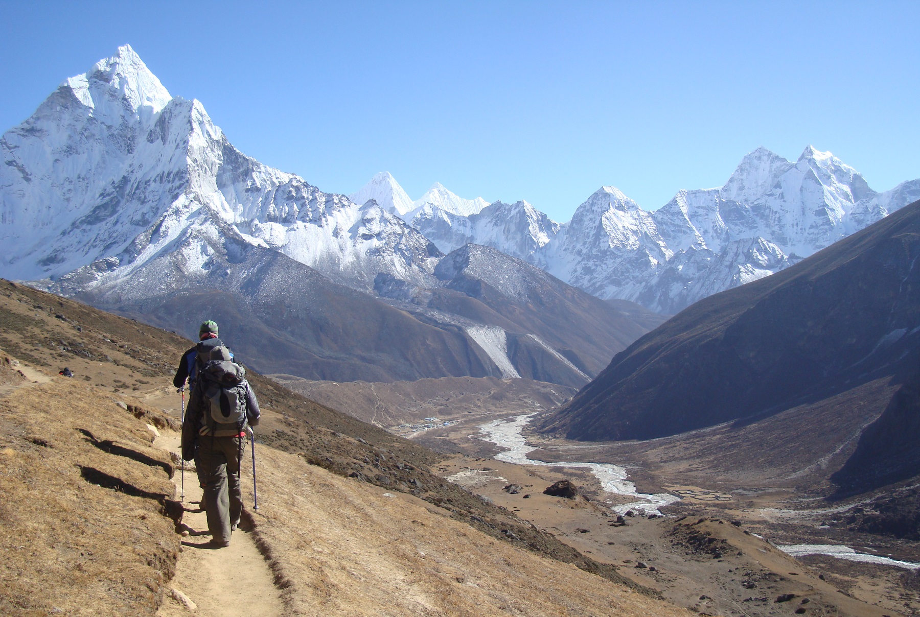
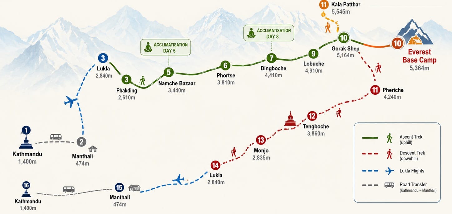
A 16-day guided Everest Base Camp trek through Namche Bazaar, Phortse and Dingboche, returning through Tengboche and the lower Dudh Koshi Valley.
Everest Base Camp is the most popular trekking destination in the world without a shadow of doubt, but the journey is about far more than standing beneath Mount Everest. The route follows the Dudh Koshi Valley from Lukla to Namche Bazaar before entering the quieter mountain villages above the main trail.
Unlike many standard Everest Base Camp itineraries that follow almost the same trail in both directions, this route takes you through Phortse on the ascent and Tengboche on the return. You will experience a quieter section of the Khumbu without missing the villages, viewpoints and monasteries that make the classic route so memorable.
Additionally, from Phortse, you continue beneath Ama Dablam towards Dingboche, Lobuche and Gorak Shep, where the landscape changes from forested valleys to exposed glacial terrain.
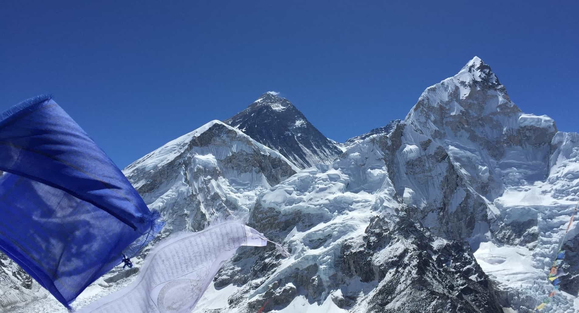
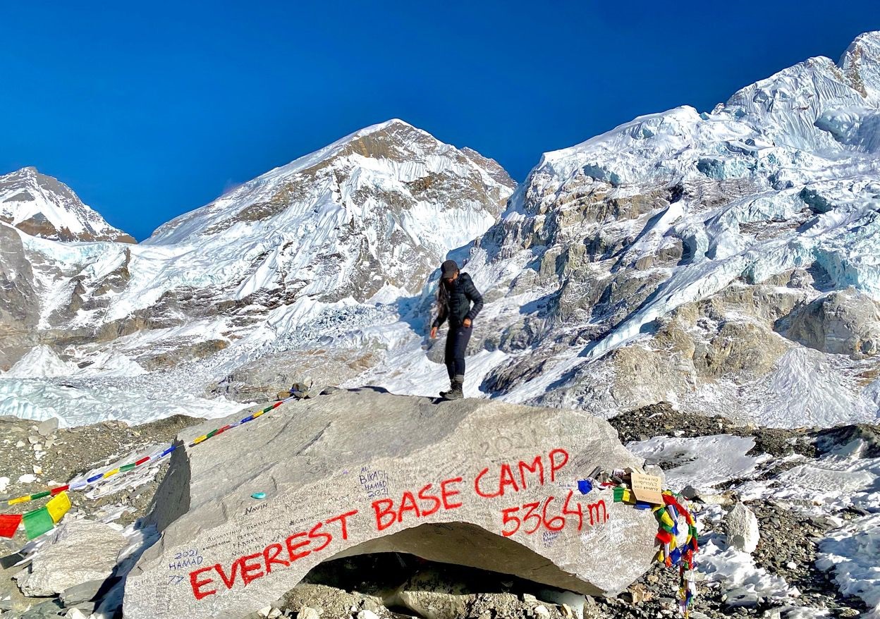
You will reach Everest Base Camp at approximately 5,364 metres and look across the Khumbu Glacier towards the Khumbu Icefall. Mount Everest itself is not clearly visible from Base Camp, which is why the itinerary also includes an early climb to Kala Patthar. At approximately 5,545 metres, Kala Patthar provides the trek’s best close-range view of Everest and the surrounding Himalayan peaks.
This is not a technical climbing expedition. You will not need ropes, crampons or mountaineering experience under normal conditions. It is still a tough journey at high altitude with long days of walking, cold weather, simple places to stay, and nearly two weeks of traveling without a break.
The itinerary includes acclimatisation stops in Namche Bazaar and Dingboche. These are essential parts of the route and are not treated as optional rest days.
Namaste and welcome to Nepal.
A member of our local team will meet you at Tribhuvan International Airport and transfer you to your hotel in Kathmandu.
Depending on your arrival time, you may have a few hours to explore Thamel, exchange money or buy any trekking equipment you have forgotten.
Kathmandu is the best place to sort out missing gear. Once you reach the mountains, the choice becomes smaller and the prices usually become higher.
Your trek begins properly with a welcome meeting at [confirmed time].
This is not one of those meetings where everyone introduces themselves and then immediately leaves.
Your guide will explain the route, altitude precautions, luggage restrictions, Lukla flight arrangements and what you should expect from the teahouses.
We will also collect:
Your main trekking equipment may also be checked.
If you are missing a sleeping bag, down jacket or trekking poles, there will still be time to hire or buy them in Kathmandu.
Tonight, enjoy an included welcome dinner with the group.
It gives you the chance to meet the people you will be walking with before everyone disappears into their rooms to repack the same bag three or four times.
After breakfast, leave Kathmandu and travel east towards Manthali in the Ramechhap district.
During the busiest trekking seasons, many Lukla flights operate from Manthali rather than Kathmandu.
Some itineraries deal with this by leaving Kathmandu in the middle of the night, driving for several hours, flying to Lukla and then starting the trek immediately.
We do it differently.
Travelling to Manthali today gives you the chance to rest before the flight and avoids beginning the trek after a long, sleepless journey.
The road passes hills, towns, rivers and rural settlements.
The journey can take longer than expected because Nepalese roads have their own understanding of time. Traffic, roadworks, rain and landslides can all affect the drive.
Tonight, stay in a sturdy safari-style tent close to Manthali Airport.
The accommodation is simpler than your Kathmandu hotel, but it allows you to eat, organise your luggage and sleep before the early flight.
Take an early flight to Lukla, the main gateway to the Everest region.
The flight is short, but the approach to Lukla is something you are unlikely to forget quickly.
After landing, meet the porters and the rest of the mountain team.
Your main duffel bag will be handed to the porters. You will carry your daypack with water, layers, medication, documents and other items you need during the walk.
The trail begins through Lukla before joining the path above the Dudh Koshi Valley.
Despite travelling towards Everest, much of today’s route descends.
The trail passes stone houses, small farms, prayer wheels, mani walls and suspension bridges before reaching Phakding.
Today is deliberately short.
It gives you time to adjust to the trail after the road journey and mountain flight.
Lukla flights are one of the most unpredictable parts of the trek.
Cloud, wind and poor visibility can delay or cancel flights with very little warning.
And unfortunately, the mountains do not care that you have a carefully organised itinerary.
We will attempt to fly as planned.
When the flight is cancelled, the group will remain near the departure airport or return to the arranged accommodation.
Another attempt will be made when conditions allow.
The local operator may try to arrange a shared helicopter.
This depends on:
Helicopters are also affected by poor weather.
A helicopter cannot be guaranteed.
You may need to use your emergency funds to cover the supplement. Allow up to approximately US$500 per person, although the actual price may be higher or lower.
The guide will protect the main ascent and acclimatisation schedule as far as possible.
A lower-altitude descent day may be combined later.
We will not remove essential acclimatisation days simply to recover lost time.
There may eventually be too little time to complete the Everest Base Camp route safely.
The operator may then offer a road-accessible alternative trek or a revised Nepal programme.
The exact outcome depends on the number of days remaining and the booking terms.
You may need to stay an additional night in Lukla.
Additional accommodation, meals, helicopter transfers and replacement international flights may not be included.
This is why we recommend keeping an extra day in Kathmandu after the trip.
The day begins beside the Dudh Koshi River.
You will walk through pine forest, pass small villages and cross several suspension bridges.
At Monjo, your permits will be checked before entering Sagarmatha National Park.
The trail then descends towards Jorsale, the final major settlement before Namche Bazaar.
After Jorsale, you cross more bridges before reaching the Hillary Suspension Bridge, hanging high above the river.
The hardest part begins after the bridge.
The trail climbs steadily through the forest towards Namche. There are very few flat sections where you can properly recover.
When the weather is clear, you may get your first distant view of Mount Everest during the climb.
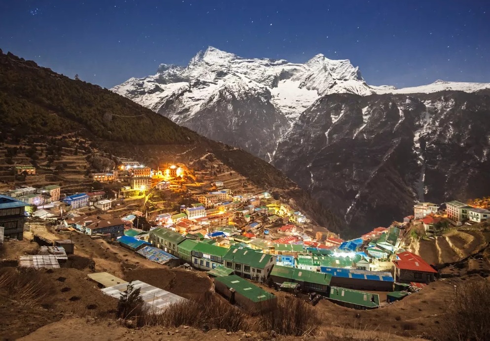
Eventually, Namche Bazaar appears across the steep hillside.
It is the largest town on the route and the main commercial centre of the Khumbu.
After the long climb, the cafés and bakeries may feel like an unexpected luxury.
Today is called an acclimatisation day, but it is not a day for lying in bed until lunchtime.
Your guide will lead a walk above Namche.
The exact route depends on the weather, trail conditions and how the group is feeling.
A common route climbs towards the Tenzing Norgay Memorial and Sagarmatha National Park Museum before continuing towards the Everest View Hotel.
When the sky is clear, you may see Everest, Lhotse, Nuptse, Ama Dablam and Thamserku.
The walk may continue towards Khumjung and Khunde.
You then return to Namche to sleep at the same altitude as the previous night.
This is the basic principle of walking higher and sleeping lower.
The afternoon is free to rest, explore Namche or make any final equipment adjustments.
Leave Namche on the high trail above the Dudh Koshi Valley.
The first part of the walk gives you broad views across the valley when the sky is clear.
At Sanasa, the route separates from the main trail towards Tengboche.
You will climb towards Mong La before descending steeply towards the river.
And then, because this is the Himalayas and flat walking is apparently too much to ask, you climb again towards Phortse.
This is why the day is harder than the difference between the starting and sleeping altitudes suggests.
Phortse sits in a quieter part of the Khumbu, surrounded by stone walls, terraced fields and steep mountain slopes.
Many families in the village have links with mountaineering, guiding and high-altitude expedition work.
Tonight will feel quieter than Namche.
The facilities will also be more limited.
This is one of the longest and hardest days of the ascent.
The trail from Phortse traverses the hillside high above the valley towards Pangboche.
There are repeated climbs and descents, exposed sections and wide views towards Ama Dablam.
Pangboche is one of the oldest permanent Sherpa settlements in the upper Khumbu.
From here, continue towards Shomare.
Trees become increasingly sparse as you climb. The landscape becomes drier, colder and more exposed.
The trail eventually separates between Pheriche and Dingboche.
You will follow the route towards Dingboche, cross the river and climb into the village.
Dingboche sits in the Imja Valley, surrounded by stone-walled fields traditionally used to grow barley and potatoes.
You will spend two nights here.
Walking time: Approximately 3–5 hours
Leave Dingboche and climb gradually above the village.
The trail crosses an open valley with views towards Cholatse, Taboche and the surrounding peaks.
Although the gradient is initially moderate, the altitude makes the walking slower.
You will descend towards Thukla, where the group normally stops before the steepest climb of the day.
Above Thukla, the trail climbs sharply towards a ridge covered with memorials to climbers and Sherpas who have died in the Himalayas.
It is a sobering place.
Your guide may explain some of the stories connected with the memorials.
From the ridge, the trail becomes gentler but remains exposed as it continues towards Lobuche.
Lobuche is small, cold and surrounded by rocky terrain.
Facilities are noticeably more basic than in Dingboche.
Today you reach Everest Base Camp.
The trail leaves Lobuche and continues beside the Khumbu Glacier towards Gorak Shep.
The route is rougher than the distance suggests.
You will cross rocky moraine and repeated small rises and dips. At this altitude, even a short climb can feel much longer than it looks.
After reaching Gorak Shep, check into the teahouse and eat before continuing towards Base Camp.
The route crosses more uneven glacial moraine.
There are no trees and no permanent villages here. Only rock, ice and high mountain walls.
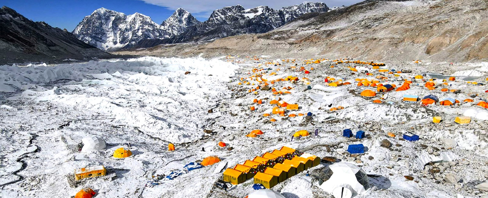
Everest Base Camp changes with the season.
During the spring climbing period, expedition tents spread across the glacier. Outside the climbing season, the area is much quieter.
You will see the Khumbu Icefall, where expedition climbers begin their route above Base Camp.
However, the summit of Everest is not clearly visible from here.
After spending time at Base Camp, return to Gorak Shep.
The climb to Kala Patthar normally begins before breakfast.
The path rises steeply behind Gorak Shep.
It is not technically difficult, but the altitude, cold and early start make it one of the hardest parts of the trek.
As you climb, Everest appears behind Nuptse, with Pumori above Kala Patthar and the Khumbu Glacier below.
This is the best close-range view of Everest available on the standard Base Camp route.
You do not need to reach the highest point to see the mountain.
After returning to Gorak Shep, eat breakfast, collect your luggage and begin descending.
You will pass through Lobuche and Thukla before continuing towards Pheriche.
The large drop in altitude usually makes breathing feel easier, although your knees may have a different opinion by the end of the day.
Leave Pheriche and continue down the valley towards Orsho and Shomare.
Vegetation gradually returns as you lose altitude.
The trail passes Pangboche before descending towards the river.
Although the overall journey is downhill, the route has not finished with climbing.
After crossing the river, you will climb through forest towards Tengboche.
The final ascent often feels harder than people expect.
Tengboche sits on a broad ridge with views towards Ama Dablam, Everest, Lhotse and Nuptse when the weather is clear.
The village is best known for Tengboche Monastery.
You may have time to visit after arriving.
The day begins with a steep descent through rhododendron and pine forest.
After crossing the river, the trail climbs again towards Sanasa.
This section surprises people who assume the whole return journey will be downhill.
From Sanasa, follow the high trail back towards Namche Bazaar.
You will normally stop in Namche for lunch.
After lunch, begin the long descent towards the Hillary Suspension Bridge.
Continue through Jorsale and leave Sagarmatha National Park before reaching Monjo.
Although you are at a much lower altitude, this remains a long day.
Repeated stone steps place considerable pressure on the knees.
Today is your final day on the trail.
Follow the Dudh Koshi Valley through villages and across familiar suspension bridges.
The route passes through or near Phakding before continuing towards Lukla.
The starting and finishing altitudes are almost the same, but the trail still contains repeated climbs and descents.
The final ascent into Lukla is longer than many people expect.
Arrive during the afternoon and spend the final evening with the mountain team.
This is normally when travellers thank and tip the guides and porters.
After almost two weeks in the mountains, Lukla may feel surprisingly busy.
Take an early flight from Lukla, subject to suitable weather.
When the flight lands in Manthali, continue to Kathmandu by road.
The drive may take most of the day depending on traffic and road conditions.
When flights operate directly to Kathmandu, you will return much earlier.
After checking into your hotel, take time to shower, rest or explore the city.
Tonight, enjoy an included farewell dinner with the group.
You have earned it.
Enjoy breakfast before checking out.
A transfer to Tribhuvan International Airport is included, provided you have supplied your flight details in advance.
When your flight leaves later in the day, you may have time for some final shopping or sightseeing.
You carry your daypack during the trek. Your main duffel is carried by a porter and is usually limited to around 10 kg per trekker, although allowances vary between operators.
Dress in lightweight layers that can be added or removed as temperatures change. Avoid cotton because it absorbs moisture and dries slowly.
Wear your trekking boots regularly before the trip. Gaiters and microspikes are generally only needed during winter or when snow and ice are expected.
Teahouse bedrooms are usually unheated. For most spring and autumn treks, choose a sleeping bag with a comfort rating of around −10°C to −15°C. Winter departures may require a warmer bag.
Carry at least two litres of water capacity and a reliable purification method. Always follow the instructions provided with your chosen treatment product.
Bring your regular medication and a small personal first-aid kit. Speak to a doctor or travel-health professional before taking altitude medication.
Charging is available at many teahouses for a fee, but it becomes more expensive and less reliable at higher elevations. Cold temperatures also reduce battery life.
Your insurance must cover trekking to the highest altitude on your itinerary and emergency helicopter evacuation. Carry enough Nepalese rupees because card payments and ATMs are unreliable along the trail.
The plan includes two specific acclimatisation days: the first in Namche Bazaar at 3,440 m and then again in Dingboche at 4,410 m.
Following the proven ‘climb high, sleep low’ principle these stops give your body extra time to adjust slowly before the trek continues above 5,000 meters, which helps lower the risk of altitude-related issues.
Your head Sherpa guide (trained in Wilderness First Aid) carries a pulse oximeter and will perform daily health checks during the trek.
They’ll monitor your blood oxygen levels and heart rate, along with how you’re feeling, to catch any changes that might mean you’re having trouble with the altitude.
Acute Mountain Sickness (AMS) can happen to anyone, no matter their age, fitness level, or past trekking experience.
Common early signs include headaches, nausea, dizziness, loss of appetite, unusual tiredness, and trouble sleeping.
Trekkers are encouraged to keep a consistent pace and drink about 3–4 liters of water each day.
Diamox (acetazolamide) can help prevent or treat altitude sickness but should only be taken with proper medical advice.
It’s important to remember that it’s not a substitute for adequate acclimatization or descending if symptoms get worse.
If a trekker starts experiencing severe or rapidly worsening symptoms, descending will be prioritized over heading towards Everest Base Camp.
A dedicated guide or assistant will immediately accompany the affected trekker to a lower altitude while the team organises additional support.
In areas where regular mobile coverage is not available, satellite communication can be utilized to reach necessary support services.
If needed, an emergency helicopter evacuation can be arranged, depending on weather conditions, aircraft availability, and the traveler’s insurance coverage.
Flights to Lukla do not always operate directly from Kathmandu. During the busier trekking seasons, particularly in spring and autumn, flights are often routed through Manthali Airport in Ramechhap to reduce congestion at Kathmandu Airport.
The exact arrangement depends on the season and airline schedule, so we will confirm your departure airport before the trek begins.
If your Lukla flight departs from Ramechhap, we will arrange the overland transfer from Kathmandu to Manthali Airport.
The drive usually takes around four hours or more, depending on traffic and road conditions. Because Lukla flights normally operate in the morning, this often means leaving Kathmandu very early.
Flights to and from Lukla are highly dependent on visibility, wind and mountain weather. Delays and cancellations are not unusual and can happen even during the main trekking seasons.
If conditions are not suitable for safe flying, the flight may be delayed, rescheduled or moved to the following day. Mountain weather can change quickly, so flexibility is an important part of travelling in the Everest region.
If your outbound flight to Lukla is delayed or cancelled, our team will work with the airline and adjust the arrangements where possible.
Depending on the length of the delay, this may mean waiting for the next available flight or making reasonable changes to the trekking schedule. We will not try to recover lost time by rushing the ascent or removing essential acclimatisation days.
If your return flight from Lukla is disrupted, we will assist with revised flight and ground-transfer arrangements based on the options available at the time.
We strongly recommend keeping at least one, and preferably two, spare days in Kathmandu after the trek before your international flight or any other fixed travel plans.
Lukla flight delays can affect your return to Kathmandu, and having extra time at the end of the trip gives you a much safer margin if the weather causes disruption.
Avoid booking an international flight or another important connection on the same day you are scheduled to fly back from Lukla.
Accommodation throughout the trek is in locally run teahouses and mountain lodges. Rooms are generally simple and twin-share, with two single beds, mattresses, pillows and blankets. Facilities become more basic as you travel higher, and bedrooms are usually unheated.
At lower elevations, some lodges offer attached bathrooms, while higher up you should expect shared toilets and washing facilities. Hot showers, Wi-Fi and device charging are available at many teahouses for an additional charge, but availability becomes less reliable and prices increase with altitude.
A warm sleeping bag is recommended even when blankets are provided.
Teahouses provide breakfast, lunch and dinner along the route. Typical meals include dal bhat, noodles, soups, fried rice, potatoes, pasta, eggs, porridge and other simple local and Western-style dishes. Vegetarian choices are widely available.
Menus tend to become smaller and more expensive at higher elevations because food and supplies must be carried into the mountains.
Your itinerary will specify which meals are included in the trip price. Drinks, snacks and additional food outside the included meal plan are normally paid for separately.
Do not drink untreated tap, stream or river water during the trek.
Carry around two litres of reusable water capacity and refill along the route. Boiled drinking water is available from teahouses for a charge, and trekkers should also carry a reliable water-treatment method such as purification tablets, an appropriate filter or a UV purification device.
Always follow the manufacturer’s instructions when treating water.
Using refillable bottles and treated water is preferable to relying on disposable plastic bottles, helping reduce waste along the Everest trail.
You will be provided with an individual duffel bag in Kathmandu for the clothing and equipment carried by the porter during the trek. Your trekking bag is limited to 10 kg per person, so pack lightly and bring only what you need in the mountains.
Any luggage that you do not need on the trek can be left securely in Kathmandu and collected when you return.
Your porter may reach the next teahouse before or after you, so anything you might need during the walking day should remain in your daypack rather than your duffel.
You only carry your own daypack while trekking. It should contain the essentials you may need during the day, including water, snacks, waterproof clothing, an extra warm layer, sunscreen, medication, valuables and your phone or camera.
Everything else, including your sleeping bag and spare clothing, can travel in your porter-carried duffel.
Each porter normally carries the trekking bags of two trekkers, together with their own personal backpack.
We limit the load to a maximum of 25 kg per porter, including the trekking luggage they are responsible for carrying. Keeping your own duffel within the 10 kg allowance helps us maintain reasonable loads for the porter throughout the trek.
Please do not bring unnecessary equipment simply because porter support is included. Travelling light makes the journey easier for everyone involved.
You do not need to purchase every piece of specialist trekking equipment before travelling. Items such as sleeping bags, down jackets and trekking poles can be hired in Kathmandu before the trek.
Seasonal equipment such as gaiters and microspikes can also be arranged when conditions require them.
Your trekking team can help you identify any missing equipment and arrange suitable rental gear before leaving Kathmandu.
We strongly recommend bringing your own well-fitting trekking boots and wearing them regularly before travelling. Boots, socks, base layers and other equipment where fit and personal comfort matter are better tested before arriving in Nepal.
Kathmandu has plenty of trekking shops, but quality varies considerably.
Essential equipment that you depend on for fit, waterproofing or warmth should either be brought from home or carefully checked before hiring or purchasing locally.
The permits required for the standard Everest Base Camp route are arranged by our local trekking team, so you will not need to organise them separately.
Your trip includes the required Khumbu Pasang Lhamu Rural Municipality permit/Trek Card and Sagarmatha National Park Entry Permit. The current Sagarmatha National Park entry fee for foreign nationals is NPR 3,000.
Keep your passport accessible when travelling, as your details may be required when permits are issued or checked along the route.
You are responsible for obtaining the correct visa for Nepal before travelling. Many nationalities can obtain a tourist visa on arrival or complete the online application process before travelling, although eligibility depends on your nationality. Nepal’s Department of Immigration currently requires passports to have at least six months’ validity.
Visa requirements can change, so check the latest rules for your nationality before departure. Your Nepal visa is separate from the trekking permits included with your trip.
To join this trek, you must have comprehensive travel insurance that specifically covers trekking up to at least 6,000 metres.
Although Everest Base Camp itself is at 5,364 m, the itinerary reaches higher viewpoints, and a 6,000 m policy provides appropriate cover for the full trekking route.
Your policy must include:
Standard travel insurance policies often impose altitude limits, so do not assume that ordinary trekking or hiking cover is sufficient.
Bring your insurance policy number and your insurer’s 24-hour emergency assistance contact details with you. We may ask to see proof of appropriate insurance before the trek begins.
Bring enough Nepalese rupees in cash to cover your personal expenses throughout the trek. Do not rely on being able to withdraw money once you are in the mountains.
ATMs are available in Kathmandu and can also be found in places such as Namche Bazaar, but machines outside the main tourist centres can be unreliable. UK government travel advice similarly warns that ATMs may not be available or dependable outside major tourist areas.
Cash may be needed for expenses such as:
We recommend withdrawing sufficient Nepalese rupees in Kathmandu before leaving for the trek, while keeping a separate bank card and a small emergency cash reserve as backup.
Prices generally increase as you travel higher because supplies have to be transported further into the mountains.
The ideal seasons are spring (March–May) and autumn (September–November) when the weather is clear, the skies are bright, and mountain views are at their best.
Yes, you can trek independently, but hiring a local guide and porter is highly recommended for safety, navigation, and cultural insight.
Wi-Fi is available in most teahouses (for a small charge), and local SIM cards (like Ncell) provide intermittent coverage along the route.
Start training at least 6–8 weeks before departure with a mix of cardio (hiking, running, cycling) and strength training. Focus on endurance and leg conditioning.
The most popular times to trek to Everest Base Camp are spring, from March to May, and autumn, from late September to November. These periods generally offer the best combination of clearer mountain views, more stable conditions and manageable temperatures.
Winter trekking is possible but brings much colder temperatures, shorter days and a greater chance of snow and ice. The summer monsoon brings warmer conditions but also cloud, rain, muddy trails and a higher likelihood of disrupted mountain flights.
The best time ultimately depends on whether you prioritise warmer temperatures, quieter trails or the clearest mountain views.
Yes. You can travel to Nepal on your own and join the trek without having to find a trekking partner beforehand.
Travelling alone does not mean trekking independently. You will trek with the guide and support team arranged for your departure, so you still have professional support throughout the journey.
Wi-Fi and mobile coverage are available in many settlements along the Everest Base Camp route, but neither should be expected to work consistently throughout the trek.
Some teahouses provide Wi-Fi for an additional charge, while mobile reception varies considerably depending on your location and network. Connectivity generally becomes less reliable at higher elevations.
Device charging is available at many teahouses, usually for a fee. Bring a power bank and keep batteries warm at higher elevations because cold temperatures can reduce battery performance significantly.
You do not need to be an athlete, but you should arrive comfortable with walking for several hours on consecutive days.
Begin training several weeks or preferably a few months before departure. Regular hill walking is one of the best forms of preparation because it develops both cardiovascular fitness and the leg strength needed for long ascents and descents.
Your training can include:
Gradually increase the duration and difficulty of your training rather than trying to make large improvements immediately before travelling.
Previous multi-day trekking experience is helpful but not essential for Everest Base Camp.
The route does not involve technical climbing, ropes or mountaineering skills. The challenge comes from walking for many consecutive days, significant changes in elevation and spending extended periods at high altitude.
New hikers can finish the route if they get fit, follow a good schedule, and feel okay with simple mountain places to stay.
The trek is led by an experienced lead Sherpa guide who manages the daily trekking schedule, monitors the group and makes decisions based on trail, weather and altitude conditions.
Your guide also does daily health checks. This includes using a pulse oximeter to measure blood oxygen levels and heart rate, and checking how each trekker feels.
Porters support the trek by carrying your main trekking luggage, leaving you responsible only for your daypack during the walking day.
Everest Base Camp is not a race, and trekkers naturally walk at different speeds.
You should maintain a steady pace that feels comfortable rather than trying to keep up with faster members of the group. Walking too quickly is particularly unhelpful at altitude, where allowing your body time to adjust is more important than reaching the next teahouse first.
Your trekking team monitors the group and manages different walking speeds where necessary. Always tell your guide if you are struggling or beginning to feel unwell.
Vegetarian meals are widely available throughout the Everest Base Camp route. Dal bhat, vegetable curries, noodles, soups, fried rice, potatoes and other meat-free dishes are commonly served in teahouses.
Vegan and some other dietary requirements can usually be accommodated, although choices become more limited and repetitive at higher elevations.
Tell us about your dietary requirements before travelling so that the trekking team can prepare accordingly.
If you have a serious food allergy, let us know before booking. Teahouse kitchens are small and shared, so complete protection against cross-contamination cannot always be guaranteed.
Best Seller