

Last checked 20 November 2026. Pass conditions and rules change; confirm the latest status with your guide or agency before you travel.
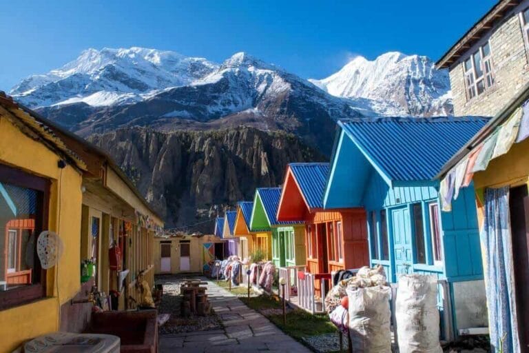
Featured image: the descent from Thorong La towards Muktinath. Photo: Simon English / Unsplash.
Thorong La Pass is a 5,416 m mountain pass on the Annapurna Circuit in central Nepal, linking the Manang valley with Muktinath and the Kali Gandaki. It is not a technical climb, but it is the highest point most trekkers will ever walk over, and crossing day is long: a pre-dawn start from Thorong Phedi or High Camp, a steady climb in thin air, then a descent of more than 1,500 m to Muktinath.
This guide explains what actually happens on crossing day, where to sleep the night before, how weather closes the pass, what the altitude rules mean in practice and what to do if you cannot cross. It sits alongside our full Annapurna Circuit trek guide, which covers the whole route, itinerary and costs.
Thorong La at a glance
| Fact | Detail |
|---|---|
| Altitude | 5,416 m (17,769 ft) |
| Location | Damodar Himal, between Manang (Manang district) and Muktinath (Mustang district) |
| Usual direction | East to west: Manang → Thorong Phedi or High Camp → pass → Muktinath |
| Last night before the pass | Thorong Phedi (about 4,450–4,540 m) or High Camp (about 4,880 m) |
| Descent to | Muktinath / Ranipauwa (about 3,750–3,800 m) |
| Crossing day | Typically 7–10 hours from Phedi to Muktinath; plan on a 4–5 am start |
| Permits | ACAP entry permit and TIMS card; a licensed guide is officially required |
| Usual season | Mid-September to November, and March to May |
Published altitudes for the lodges vary by up to about 100 m between sources. The figures above are ranges, not survey points.
Where is Thorong La Pass and how high is it?
Thorong La sits at 5,416 m in the Damodar Himal, at the head of two valleys. To the east is the Marsyangdi valley and Manang; to the west, the arid upper Kali Gandaki around Muktinath and Jomsom. The pass links the two valleys, and crossing it is what turns the walk into a circuit.
The 5,416 m figure is the one the Nepal Tourism Board’s trade site uses, and it is the standard figure in trekking literature. You will occasionally see 5,380 m, including on one Nepal Tourism Board page. Treat 5,416 m as the working figure; the difference does not change how you plan the crossing.
Is Thorong La higher than Everest Base Camp? Yes, slightly. Everest’s South Base Camp in Nepal is usually given as about 5,364 m, so Thorong La is roughly 50 m higher. The big difference is that you do not sleep at Thorong La. You cross it and drop well over 1,500 m the same day.
Which direction should you cross?
Almost everyone crosses east to west, from Manang to Muktinath, and that is the direction to plan for. The reason is altitude, not tradition.
From the east, you gain height gradually over several days up the Marsyangdi valley, rest in Manang, then sleep at around 4,500–4,900 m before the climb. From the west, Muktinath is at roughly 3,800 m, so the pass would mean a climb of about 1,600 m in a single day, with only a seasonal lodge partway up to break it. Manang to Muktinath in one day is not realistic in either direction.
The west-to-east crossing is possible for very well-acclimatised trekkers, but it is the exception. If you are coming from Mustang and want to cross, take expert advice first and build in nights at intermediate altitude.
Thorong Phedi or High Camp: where to sleep the night before
The choice is a trade-off between a shorter summit morning and a higher, colder night.
| Factor | Thorong Phedi | High Camp |
|---|---|---|
| Approximate altitude | 4,450–4,540 m | 4,880 m |
| Climb to the pass | Roughly 900 m | Roughly 540 m |
| Typical time to the top | About 4–6 hours | About 2.5–4 hours |
| The night | Lower and a little warmer | Higher and colder; more likely to give a poor night’s sleep or a headache |
| Suits | Anyone unsure how they are acclimatising | Trekkers who are clearly well acclimatised and want a shorter morning |
The climb from Phedi to High Camp is short but steep. Some people walk it the afternoon before as an acclimatisation hike and come back down to sleep at Phedi. That is a sensible option if there is a bed at Phedi and you are unsure about sleeping higher.
The rule to follow: if you have any headache, nausea or unusual breathlessness at Phedi, do not go up to High Camp to sleep. That is the classic way people turn a manageable problem into a dangerous one.
What actually happens on crossing day
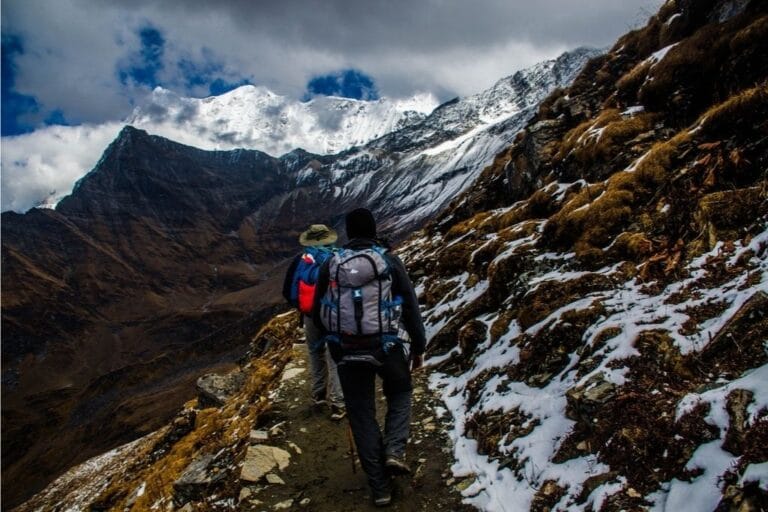
Crossing day is long, cold and mostly simple underfoot. The trail is a well-trodden path with no ropes or technical sections in normal conditions. Here is how the day usually runs.
- Wake up around 3:30–4:00 am. Lodges serve an early breakfast. Eat something even if you are not hungry, and fill your water before you leave.
- Leave between about 4:00 and 5:00 am. You walk by head torch for the first hour or so. The reason for the early start is wind: on Thorong La it typically picks up a few hours after sunrise, and the afternoon can be brutal on the exposed top.
- Climb steadily. From Phedi, the first section, up to High Camp, is the steepest. Above that, the path rises in a long series of false summits. Small steps and regular breathing work better than fast bursts and long stops.
- Reach the top mid-morning. Most people arrive somewhere between about 8 am and 10 am. Take your photos, eat and drink something, and do not linger in the cold.
- Descend to Muktinath. The way down is roughly 1,600 m of steep, loose descent, which takes most people 3–5 hours. It is hard on knees, and it is where many trips feel longest. Trekking poles help.
- Arrive at Muktinath (Ranipauwa) in the early to mid afternoon. Ranipauwa is the lodge village just below the Muktinath temple complex.
In total, plan on 7–10 hours from Phedi to Muktinath, and a little less from High Camp. These are typical published ranges, not promises. Fresh snow, illness, slow companions or a late start all stretch the day.
Thorong La weather and when the pass closes
The pass is usually crossable from mid-September to November and from March to May, but it can close at any time after heavy snow. In winter (December to February) the trail can carry snow, temperatures at the top commonly fall well below freezing, and some lodges at Phedi and High Camp shut. Crossing in winter is possible on clear spells, but only with an experienced guide and flexible days. The monsoon season (the UK Foreign Office gives June to October) brings cloud, rain lower down, and floods and landslides that damage roads and trails in the valleys.
Recent seasons show how quickly things change:
- October 2014: a snowstorm linked to the remnants of Cyclone Hudhud trapped trekkers around the pass. Forty-three people died in the wider Annapurna area and more than 500 were rescued, many by helicopter. It remains the reason guides take forecasts seriously here.
- Late September 2026: the Manang district authorities suspended high-altitude trekking, including Thorong La, after heavy snowfall, and floods damaged the road below Chame. More than 150 trekkers turned back from the pass. Snow was cleared and the Manang–Mustang route reopened in early October, and arrivals had largely recovered by the Dashain holiday.
- Late October 2026: Cyclone Arnab brought heavy rain to Manang. Trekkers were still reported crossing from Manang into Mustang via Thorong La on 30 October.
We could find no official notice on the pass’s status after 1 November 2026. Before you commit, check the latest district and ACAP advisories with your guide or agency, and build at least one spare day into your plan so you can wait out bad weather rather than gamble on it. Our Nepal trekking after the 2026 floods update covers wider route damage.
Altitude: the part that actually decides whether you cross
Fitness gets you to Manang; acclimatisation gets you over Thorong La. The main risk on the pass is altitude illness, not the terrain.
UK health guidance from TravelHealthPro and the NHS is consistent: above 3,000 m, avoid increasing your sleeping altitude by more than 500 m a night, and take a rest day at the same altitude every three or four days. The Himalayan Rescue Association recommends being more cautious still, at about 300–400 m a night. On the Annapurna Circuit that usually means:
- At least one full rest day in Manang (about 3,540 m), walking higher during the day and sleeping at the same height. Some itineraries allow two.
- A night at Yak Kharka or Letdar (about 4,000–4,200 m) before Phedi, rather than going straight from Manang to Phedi.
- Not sleeping at High Camp unless you are clearly well.
The Himalayan Rescue Association runs an aid post in Manang, at about 3,550 m, staffed by volunteer doctors during the main trekking seasons, and the Nepal Tourism Board says it holds daily altitude talks there in spring and autumn. Check it is open when you pass through; we could not confirm its autumn 2026 dates. There is no longer an HRA clinic at Thorong Phedi.
When to turn back: a headache that does not clear with rest and fluids, vomiting, confusion, loss of coordination or breathlessness at rest are reasons not to climb higher. The last two are emergency signs: descend at once. If you feel worse at Phedi or High Camp, the safe direction is back down towards Manang, not over the top. Our Nepal trekking safety guide covers altitude illness and emergency steps in more depth. Ask your doctor or a travel clinic about medication such as acetazolamide before you go; do not take dosing advice from a trekking blog.
Permits and the guide rule
You need an Annapurna Conservation Area Project (ACAP) entry permit and a TIMS card, and foreign trekkers are officially required to walk with a licensed guide.
- ACAP permit: NPR 3,000 for foreign nationals and NPR 1,000 for SAARC nationals, from the National Trust for Nature Conservation online or at its counters in Kathmandu and Pokhara. Permits bought at a trail checkpoint cost double.
- TIMS card: NPR 2,000 (NPR 1,000 for SAARC nationals), issued through a government-registered trekking agency.
- Guide rule: since 1 April 2023 the Nepal Tourism Board has required foreign trekkers in specified protected areas, including the Annapurna region, to be accompanied by a licensed guide. UK Foreign Office advice also says independent trekkers must use a local guide or porter in national parks and protected areas. Enforcement has been reported as uneven, but plan as if the rule applies.
The March 2026 change allowing a single trekker to get a restricted-area permit (for example Nar Phu or Upper Mustang) does not change anything for the standard Annapurna Circuit, which is not a restricted area.
What to do if you can’t cross
If the pass is closed, or you are not well enough, you have three realistic options.
- Wait. If the problem is weather and you are acclimatising well, a spare day at Phedi or Manang is often enough. This is why the spare day matters.
- Go back down the Marsyangdi. From Manang, roads run down the valley towards Besisahar, so you can leave by jeep. You miss Muktinath and the Kali Gandaki, but you are safe.
- Helicopter evacuation, for medical emergencies only. Helicopters can and do fly in this area, but they depend on weather and cost a great deal. The UK Foreign Office says evacuation usually costs between £1,000 and £2,000 or more per flying hour. Your travel insurance must cover trekking to at least 5,500 m and helicopter rescue — our guide to trekking travel insurance explains what to check. The Foreign Office also warns about guides who push a fast ascent and then call in an evacuation they profit from; a sensible itinerary is your best defence.
Mobile coverage on long stretches of the circuit is limited, so agree an emergency plan with your guide before crossing day, not on it.
How hard is Thorong La?
For a fit, well-acclimatised walker in good weather, Thorong La is a hard day rather than a dangerous one. The path is non-technical. What makes it hard is the combination of an early start, cold, altitude and a long, knee-jarring descent.
It is a reasonable goal for someone who has done multi-day hill walking and is happy walking 6–8 hours a day for a fortnight. It is a poor first trek for someone who has never walked consecutive long days, and it is not the place to test how your body handles altitude for the first time without a guide. If you want a lower first trek in the same region, our Annapurna region guide compares the options.
What to pack for crossing day
The usual Circuit kit list applies; for the pass itself, the items that matter most are:
- Warm layers you can wear walking: a base layer, fleece, insulated jacket and a windproof shell.
- Hat, buff and two pairs of gloves (a thin pair for walking, a warm pair for the top).
- Head torch with spare batteries, kept warm in an inside pocket.
- At least 2 litres of water, in bottles insulated against freezing, plus snacks you will actually eat at altitude.
- Sunglasses and high-factor sun cream — the glare on snow is intense once the sun is up.
- Trekking poles for the descent.
- Microspikes if there has been recent snow; ask in Manang or at Phedi what conditions are like.
Before and after the pass: Manang and Muktinath
Manang is where you prepare; Muktinath is where you recover. Our Manang village guide covers acclimatisation walks, lodges and what to stock up on before prices rise higher up. On the far side, most trekkers spend the night in Ranipauwa, the lodge village below the Muktinath temple complex. From there, the usual onward route runs down the Kali Gandaki towards Jomsom for a flight or road journey to Pokhara.
Thorong La Pass FAQs
How high is Thorong La Pass?
Thorong La is 5,416 m (17,769 ft) above sea level, the high point of the Annapurna Circuit.
How long does it take to cross Thorong La?
Most trekkers take 7–10 hours from Thorong Phedi to Muktinath, including 4–6 hours up to the pass and 3–5 hours down. From High Camp the climb is shorter, typically 2.5–4 hours.
Is Thorong La Pass dangerous?
The path is not technical. The real risks are altitude illness, extreme cold and sudden snowstorms, as in October 2014. A slow ascent, a pre-dawn start, a licensed guide and a willingness to wait or turn back manage most of that risk.
Is Thorong La higher than Everest Base Camp?
Yes, by roughly 50 m. Everest’s South Base Camp is usually given as about 5,364 m; Thorong La is 5,416 m.
Is Thorong La Pass open now?
It is usually open from mid-September to November and from March to May, but snow can close it at short notice, as it did in late September 2026. Check the latest district and ACAP advisories with your guide or agency before you set off.
Do I need a guide to cross Thorong La?
Officially, yes. Nepal’s licensed-guide rule covers the Annapurna region, and UK Foreign Office advice also says not to trek alone. You also need an ACAP permit and a TIMS card.
Can you cross Thorong La in winter?
Sometimes, on clear spells, but snow, very low temperatures and closed lodges make it a serious undertaking between December and February. Only attempt it with an experienced guide and spare days.
Planning the Annapurna Circuit? Our Annapurna Circuit trek guide covers the full route, day-by-day options and costs. When you are ready to talk dates, tell us what you have in mind on our plan your trip page and we will put you in touch with a licensed local ground partner.
Sources
- National Trust for Nature Conservation, ACAP entry permits and permit support
- Nepal Tourism Board, TIMS card and Safety in the mountains
- UK Foreign Office, Nepal travel advice: safety and security and health
- TravelHealthPro, Altitude illness
- Himalayan Rescue Association, Manang aid post
- Kathmandu Post, Annapurna Circuit sees trekking arrivals rebound after floods (29 Oct 2026)
- British Mountaineering Council, Storm on Annapurna prompts blizzard of promises (28 Oct 2014)